Showing posts with label Trekking. Show all posts

Sunday, 14 April 2013

Trekking Day 11: Namche Bazaar to Lukla

Namche Bazaar to Lukla: The Stats

Distance Walked: 21.9km

Hours and Minutes Taken: 7 hours, 51 minutes

Origin Altitude: Namche Bazaar, 3450m

Destination Altitude: Lukla, 2857m

Approximate Total Metres Ascended: 817m

Approximate Total Metres Descended: 1298m

Weather: A cool morning followed by a warm, clear day. Clouds and wind rolling in from midday.

Morning Temperature in our Tea House Room: 6 degrees Celsius

Chris on the steep walk down from Namche

By 6:30am this morning we were sitting in the restaurant of Hotel Namche eating large servings of muesli, hot milk and fruit. We paid our bill, had the lovely lady owner pull me up on giving her too much cash, and were then on our way. We knew we had a big day ahead of us but, at the time, we could never have imagined just how big.

To begin the morning we passed through the entrance gate of Namche, which we had accidentally missed on our way up, and started the 600m descent down the huge hill upon which Namche sits. We passed through the permit check post and continued on our way. While not as steep as the hill from Tengboché it was still a challenge for the knees and ankles. The ground made of uneven large stones covered in a layer of fine sandy dirt and small stones which made for slippery work. Nearly falling over was the norm as we slid around with every few steps. Considering the terrain we made good progress stopping only briefly to try and catch one last glimpse of the tallest mountain in the world. With the haze obscuring our view of Everest we continued down and down and down until finally we could hear, and then see, the roaring river beneath us.

The pretty stretch before Jorsalé

At the bottom of the hill was the meeting of the Dudh and Bhoté Kosi rivers. We crossed back across the incredibly high swing bridge (Larja Dhoban) and back down the stone path which took us to the bank of the Dudh Kosi. We were in familiar territory now having not only walked this rocky riverbed on our way up but having spent time down here watching Chris take photos. This stretch of trail was exceptionally scenic with pine trees lining the turquoise river. Across another familiar swing bridge we passed through the second check post for the day before entering Jorsalé.

After Jorsalé came the dreaded climb to Monjo. While only 100m or so up, the stony steps were steep and Chris' flu was not helping. He was constantly out of breath, hunching over on his walking pole with fatigue. Luckily, we had a cute dog to guide us on our way. Breathless, we passed back through the gateway which marked the entrance/exit to Sagarmatha National Park. After having our permits checked once again it was back down again, back up and back down once more. This was a pattern that would continue throughout the remainder of this long, gruelling day.
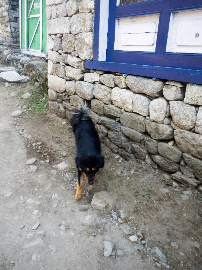
Our cute guide
Crystal clear water by the watermill

We again passed by the watermill and the waterfall (which still was barely trickling). We passed throngs of trekkers moving in the opposite direction to us and had mixed emotions about our descent as we saw their fresh eager faces.

By the time we reached Toktok we were exhausted and the day had really only just begun. We had a plan to reach Phakding by 11am so despite our exhaustion we pushed on. Through Phakding we went, following the long trail to Ghat where we planned to be by midday. Our entry into Ghat was yet another steep climb through boulders painted with Tibetan script. Our arrival at the top of the hill was marked by the mani walls, shrines and chorten that we recognised from our ascent.

We stopped for a few snacks in Ghat, not having time to stop for lunch. We needed to be in Lukla between 2pm and 4pm as these were the only hours that the Tara Air office was open and we urgently needed to change our flights. We did not want to be sitting in Lukla for any longer than necessary as Kathmandu's hot showers were calling our names. 11 days without a shower, let alone without a bucket shower, is too long. When Anando caught up we informed him that we'd push ahead and meet him in Lukla as to ensure we met our deadline.

The trail wound through the forest again going up and down more times than we could count. In an attempt to give Chris a well earned break we again swapped backpacks. The steep climbs, with that weight on my back, gave me a whole new understanding and appreciation for what Chris had accomplished over the past ten days.

Eventually we arrived in Chheplung, the town where we had spent the first night of our trek. We were a little over eager thinking we had arrived before we actually had. The series of mani walls were confusing. When we did eventually go past our old familiar guesthouse we knew we had about 3km to walk before we would reach Lukla. 3km did not sound like much but boy, we could not have been more wrong.

Having already walked over 18km today, and a similar distance yesterday, we were tired. Really, really tired. And, with Chris having the man flu and me struggling away with his bag, we were a slow moving team. While I tried my hardest to lift the morale by shouting "Go Chris!" every now and then, we were struggling. The path to Lukla seemed never ending. It went up, up and up some more. Every few metres we stopped to catch our breath but all the while we knew we had a deadline to meet so on we pushed, surprised by our own determination, or stubbornness. Up we went, up and up and up. Today was meant to be about descent but it sure felt like all we had done was walk uphill.

Like a halo rising out of the hill we saw the gateway to Lukla appear. Together we passed over the threshold and sighed as finally the ground levelled somewhat and we were on the stony streets of Lukla. We crawled our way through the Main Street and eventually found the Tara Air office that we had been told would be able to solve all of our flight related problems.

The office was bustling with people. Word on the street was that changing out flight was not going to be as simple as we originally thought, if possible at all. When we finally manoeuvred our way to the counter we were, as expected, told that getting an earlier flight was impossible thanks to all of the flights that had been cancelled today. What they really meant was...getting us on a flight tomorrow was too hard and they had no system in place to put us on any kind of waiting list. Plan B needed to be put in place.

We phoned our travel agent in Kathmandu to try and change the flight but were told that before anything could be organised we would need to find a lodge because apparently the lodge owner would be able to help us reorganise our flights. I'm sure some of the directions were lost in translation because as we set off looking for a place to stay we still weren't sure exactly what would happen next. We wandered away from Tara Air and away from the noisy Wave's Pub (which we had seen advertised every kilometre or so for the past day and a half) and kept our eyes peeled for a place to stay. The first tea house which appealed (in that it was small and inconspicuous in comparison to the large, fancy ones that lined the street) was Base Camp Lodge. Chris looked at the rooms and, before we agreed to stay, we thought we'd try and clarify with the guy in the charge what could be done about our flights. Turns out that the boss/owner of Base Camp Lodge was the manager for Tara Air. How convenient. We dumped our stuff in our room and ordered up some long-awaited food to kill time until the boss arrived.

Chris enjoyed a spaghetti bolognese of sorts (made with yak rather than beef and cheese sauce rather than tomato sauce) while I had the standard egg and veg fried noodles. We even went all out and shared a Fanta hoping the carbonation might aid in dislodging the large ball of phlegm that had gathered in Chris' throat.

When the manager finally arrived he entered wearing a silky wrap around shirt and a cowboy hat. If anybody could save the day...it was this guy. He introduced himself and told us that, while getting a flight today was not possible, he would try his best to get us on one tomorrow. He would keep us posted. Even if it meant each of us would be put on separate aeroplanes we didn't mind. It would beat spending 13 days in Lukla as suggested by the Tara Air staff. We'd have been better off walking down to Jiri than hanging here for that long.

We waited and waited for Anando to arrive and when he eventually did we showed him to his room and took a small rest. Today had really taken it out of us.

When we went downstairs to order dinner we were stopped and told that Chris (as I had told them he was sick) would be flying to Kathmandu tomorrow morning and would need to be at the airport at 6am. So, instead of having to wait until the 27th like the Tara Air people suggested, he was getting out on the next flight. As for Anando and I, well, we would just have to wait and see.

For dinner we ordered up big enjoying a Khumbu pizza (topped with pieces of yak, mushrooms and nak cheese), roast chicken with veg and fried yak momos. With a pot of hot orange tang to warm us up we were happy with our cosy choice of tea house.

We went to be bed still not knowing when anyone but Chris would be flying out. We had an early night knowing we'd be up early, eager to get off the mountain. It's funny that if we were still trekking I'm sure we'd be happy about it but, with hot water, steak and bacon only a short flight away, it was all we could think about.


Saturday, 13 April 2013

Trekking Day 10: Shomaré to Namche Bazaar

Lauren celebrating with Mt Thamserku just outside Shomaré

Shomaré to Namche Bazaar: The Stats

Distance Walked: 18.6km

Hours and Minutes Taken: 9 hours, 9 minutes

Origin Altitude: Shomaré, 4064

Destination Altitude: Namche Bazaar, 3450

Approximate Total Metres Ascended: 644m

Approximate Total Metres Descended: 1243m

Weather: A cool clear morning with the weather warming as we descended in altitude.

Morning Temperature in our Tea House Room: 8 degrees Celsius

This morning, finally, Chris did not have a headache. He did however still have all of his flu-like symptoms so we were sticking with the decision we had made last night...to descend.

Chis had his trusty muesli with hot milk for brekky while I stuck with the oat porridge. Once we packed up our things and said goodbye to our friendly guesthouse owner we walked down into the village, filled up our water bottles from a pipe in the stream and set off on our way. Apparently it would take us about 4 hours to get to Namche...yeah right! We estimated at least six hours but it turns out that even that was optimistic.

Down the hill we went, back past the yak pastures, eventually arriving in Pangboché. As we passed through Pangboché we took note of a check point for a 65km race that had been happening on the trail. We could barely walk it let alone run it so had copious amounts of respect for the contestants. As we continued out of Pangboché we could see Tengbochè in the distance and knew we had some way to go to even get there. We passed back over the steel bridges and through the woods again going through Deboché. With Chris' flu holding him back and making every breath difficult it was slow work as we got passed by many a trekker. Mind you, very few of them were carrying their own bags so we did feel a bit better about our progress.

Everest, Lhotse and Ama Dablam
Chris, barely able to lift his arms

From Deboché it was uphill to Tengboché. On our way down the hill the slope had felt gradual but today, uphill, the slight gradient resembled a mountain. Arriving in Tengboché, breathless, was well worth the climb. The mountains stood out against the blue skies forming a perfect backdrop for the Tengboché monastery. Mt Kantega, the snow saddle, was clearly visible as was the Kwangde Range as Thamserku. We snapped a few photos of Everest peering over the Lhotse-Nuptse Ridge while we caught our breath then continued on up, across the meadow, so we could begin our 570m descent down the steep hill.

Tengboché monastery
Lauren and Chris with Kantaga and Thamserku, outside Tengboché
Lauren, unhappy with all of the walking

The path rapidly descended, zigzagging its way down the hill. It was a steep, slippery slope of uneven ground causing me to almost fall on more than one occasion. The rhododendrons were in full bloom though and the weather was slowly warming up so it wasn't completely unpleasant. In saying that, as we approached the lower portion of the hill and caught glimpses of the river below, we were ready for some uphill, our thighs burning. Watching the porters with their gigantic loads made complaining difficult...their strength still never ceases to amaze us.

Another Sherpa with another load
Chris with the zigzagging slope down from Tengboché barely visible

Anando had taken off ahead of us on the downhill but this was not uncommon. Usually he would wait for us every few hundred metres or so but, because we were moving so slowly this morning, we figured he'd just gone ahead to where we had arranged to eat lunch. So, when we finally arrived in Phunki Tenga (at the same restaurant we had visited on our way up) and he wasn't there we were surprised to say the least. Could we possibly have passed him when we took the Sherpa path rather than the regular path for that short stretch coming down the hill? We ordered some fried potatoes and fried rice, both with cheese this time around, and hoped he'd turn up. He didn't.

I sent messages with fellow trekkers going both ways, up and down the mountain. "Keep your eye out for an Indian in a Canada jumper...we lost him somewhere on the hill." When I went looking for him for a second time, there he was, walking across the bridge towards Phunki Tenga, minus his backpack. I walked up to meet him and we returned to Chris at the restaurant so Anando too could have some lunch. Turns out Anando had been waiting for us somewhere on the hill, then near the check post just before Phunki Tenga, and both times we managed to somehow miss him.

Once Anando finished his lunch we began the huge hike up the hill to Sanasa...an increase in altitude of 400m. And, it was steep. So steep that on our way in the opposite direction we had done well not to slip and slide down the hill on our backsides.

But, with the oxygen levels higher than they had been for days, I was feeling great. The hills felt more manageable and I was happy to keep pushing on and on to see just how far we could walk today. Even Chris' jokes were funnier with this much oxygen in the air. Unfortunately, while the decrease in altitude must have helped Chris' 'mountain disease' somewhat he did still have the flu. The man flu at that. Struggling to breath out of both his nose and mouth it was no wonder that he was struggling up the hills. Add to that the 20kg he was carrying and he was doing well to be walking at all.

We hoped that once we reached Sanasa that the hills would level out and we would finally have just descent to worry about. No such luck. The ups and downs continued all day.

Chris, exhausted, on the walk into Namche

The walk into Namche was the longest part of the whole day. Every corner we walked around we expected to see the town awaiting our arrival. There were at least six such points, all looking the same with chortens on their corners and long paths going up and down and up and down between them. A guy passed us, out for a run, and we cursed him, barely able to walk let alone run. The walk down the stairs into Namche felt long as we knew our destination was near. There was unfortunately no way we could push on to Jorsalé today. The day was coming to a close and our legs just couldn't manage the downhill that we knew was on the other side of Namche.

When we arrived back at Khumbu Lodge, where we had stayed on our last visit to Namche, I was disappointed to be ignored and then shunned by the staff. After encountering such beautiful, kind people in the hills and knowing that Nepalis for the most part were just like this, we weren't about to waste our time with somebody like this. We went next door, paid the same price and knew our money was going to a lovely lady who was nothing but generous.

We drank tea and ate dal bhat and cheesy macaroni before bed. We were exhausted after today and knew we had just as big a day tomorrow.

Lauren, day 10 without a shower


Friday, 12 April 2013

Trekking Day 9: Dingboché to Shomaré

Dingboché to Shomaré: The Stats

Distance Walked: 4.6km

Hours and Minutes Taken: 3 hours, 2 minutes

Origin Altitude: Dingboché, 4308m

Destination Altitude: Shomaré, 4064m

Approximate Total Metres Ascended: 73m

Approximate Total Metres Descended: 297m

Weather: Blue skies but very cold and windy.

Morning Temperature in our Tea House Room: 3 degrees Celsius

When we woke up this morning about 5:30am Chris' headache was back with a vengeance. His cough seemed worse and this was the first morning that he'd had a bad headache....another sign of altitude sickness. Could the AMS possibly be getting worse despite the diamox and despite having spent two nights at the same altitude? Chris popped another diamox and we crossed our fingers. We can't have felt too hopeful though as we spent the time before breakfast convincing ourselves that one day we'd come back to Nepal and that we could do other treks in other places in the meantime that would be awesome in different ways. However, we kept going back to something Chris had said right at the beginning of our trek...no other mountains are ever going to compare to these. We had a tough decision to make and with Chris and I both being as stubborn as we are, giving up was not an easy option to take. We could go down for a night then come back up or stay here another night and then go up but still there was no guarantee that Chris would get better or wouldn't get sick again later. Was it really worth it? Seeing him this sick was horrible.

He struggled through some muesli while I tried out the oatmeal porridge and then we all sat around and drank a 'small pot' (which is actually a large thermos which seems never ending) of hot orange tang. On recommendation from the doctor we had seen earlier, tang was full of salts and sugars which would hopefully help Chris in his recovery. Plus, the warmth was soothing on the throat. We paid our bill and had the lovely surprise of being given our rooms for free.

When Chris still wasn't feeling well enough for us to stay in Dingboché we had the big task of packing up our things and starting our descent. Chris was becoming less and less 'with it' as the morning progressed. Taking longer than usual to do anything and forgetting what he was in the middle of were signs of his AMS worsening and were becoming more frequent. We needed to get down.

Once packed I convinced Chris to let me carry his heavy pack, exchanging it for mine. I knew he must have been extremely sick to agree to this. And then we were off. Every little incline between Dingboché and Shomaré felt like a mountain as Chris' fatigue meant every step was a marathon. Back we went through the windy valley, past the yak pastures, back along the Imja Khola river. It took us longer to come down the hill than it had for us to go up.

Once in Shomaré back at Everest View Lodge we ordered up a lunch of fried rice, fried potatoes and momos to see if Chris was feeling well enough to stay at this altitude of whether we would need to descend further.

We decided to spend a night in Shomaré and see how that treated Chris and his AMS. We spent a few hours napping and resting in our room and thought that maybe he would get better here. But, around 4pm, the diamox or the panadene started wearing off, the headache was back and his appetite was once again non existent. It wasn't looking good.

The decision was made. We needed to go down. As much as we had our hearts set on base camp it just wasn't meant to be this time around.

We had dinner around 7pm...vegetable fried noodles, chicken soup and fried potatoes with vegetables. These potatoes are always delicious. While we played our version (the Khumbu versn) of an old card game I sadly questioned what we would possible have to celebrate upon our arrival back in Kathmandu when really we had abandoned our goal. Anando wisely answered that we would celebrate Chris' health as well as the fact that we had been lucky enough to travel as high as we did. Good advice.

Over dinner we chatted with our guesthouse owner. Today he had walked all the way to Khumjung to retrieve his wife and 26 day old baby girl and bring them back to Shomaré. All in on day. That's about 40km up and down the Himalayas. As we chatted somehow the conversation twisted and turned and ended up with a plan for me to give birth to a male, bring him to Nepal and enter him into an arranged marriage with this guy's baby girl. Interesting.

After dinner it was an early night once again. Nepali time had well and truly taken hold of us.


Thursday, 11 April 2013

Trekking Day 8: The Medical Clinic, Pheriché

Dingboché to Pheriché (and back): The Stats

Distance Walked: 4.7km

Hours and Minutes Taken: 6 hours, 5 minutes (walking time: 3 hours, 20 minutes)

Origin Altitude: Dingboché, 4308m

Destination Altitude: Pheriché, 4287m

Approximate Total Metres Ascended: 268m

Approximate Total Metres Descended: 268m

Weather: A sunny, still morning remaining cold most of the day.

Morning Temperature in our Tea House Room: 3 degrees Celsius

Chris not wanting to emerge from his sleeping bag

When we woke up this morning Chris had a mild headache but was feeling substantially better than he was last night. We stepped outside to find Dingboché covered in a few inches of snow and it was still very chilly. We had a breakfast of muesli and hot milk and wished the guys we had met last night luck on their journey as today they set off for Lobuché. With Chris feeling better we thought we'd give acclimatising a go by climbing the big hill behind Dingboché. He popped another half a diamox and we crossed our fingers.

We rugged up and set off up the same hill we had climbed yesterday with the intention of going higher. We gained about 100m in altitude to reach the same chorten we had reached yesterday afternoon. This time though, Chris was not ok. Even after sitting for a few minutes he was struggling to catch his breath, was on the verge of throwing up and had so little energy he could barely stand. As he put it, "I almost vomited up a lung." There was no choice...we needed to get him to a doctor. The only problem was that when you're in the Himalayas, walking to the doctor is your only choice unless you want to get air lifted out. We had to get to Pheriché and walking was our mode of choice.

Located about 2km from Dingboché, Pheriché wasn't far compared to other distances we had covered. However, with Chris barely able to walk two steps without hunching over with fatigue and nausea we weren't sure we would make it at all.

As we continued down the snowy hill Chris began to feel slightly better and, as we were decreasing in altitude, the likelihood of his sickness being the result of Acute Mountain Sickness, was becoming more and more likely. We walked and rested and walked and rested and made slow progress in the direction we hoped was Pheriché. We were following footprints in the snow and hoping with every ridge we crossed that we would spot a township on the other side.

We sent Anando ahead to ensure we were on the right track while Chris and I made painfully slow progress in the same direction. Turns out we were going the right way and, as we reached the final ridge before Pheriché, spotting the village at the bottom of the hill, a wave of relief swept over us. Slowly we zigzagged down the slippery, snowy hill and found our way to the Himalayan Rescue Association Medical Clinic. We had read in the guidebook that usually the clinic had Western volunteers in attendance and we couldn't have been happier when we arrived to find two Americans waiting to greet us.

A short consultation told us that Chris did officially have Acute Mountain Sickness (AMS). Despite us following all of the rules about ascending slowly, in fact we even went slower than recommended, we hadn't managed to avoid the dreaded AMS. He was somewhere in between the beginnings of the condition and an extreme case. The doctor gave us some advice on how best to increase our chances of going higher and gave Chris another diamox to take. Before he could take it though they were hoping he would take part in a blind medical study that was testing the usefulness of two different drugs on helping with the headache and nausea associated with AMS. He agreed hoping that maybe he'd get to feel better at least for the day.

Being part of the medical trial meant hanging in Pheriché for two hours so we ordered some food at a nearby restaurant which was seriously fancy compared to our usual digs. We forced some food into Chris while he sat and filled out a half hourly log of his symptoms. When the restaurant started blaring some horrible pop music we went outside to sit in the sun to kill time until the trial was over. As bored as we were it was no doubt a good thing to rest for a couple of hours before tackling the hill back over to Dingboché.

A memorial to deceased Everest climbers, Pheriché

We checked out a memorial to climbers who have died on Everest, taking note of those names listed that were familiar thanks to our reading of Into Thin Air. The trial finished and grabbed a receipt for our $50 USD consultation in the hope we could claim it on our travel insurance. Thankfully Anando had money with him, and American Dollars at that, as Chris and I were horribly unprepared having not bought our wallet as the original plan had been acclimatisation not a diagnosis of AMS.

When Chris felt well enough to trek back to Dingboché we decided not to take any of the regular routes back over the ridge. One was too steep and the other too long so we forged our own way following Sherpa and yak paths up the hill. It was slow work but the diamox had Chris feeling worlds better than he had earlier in the day so we made it to Dingboché, via an ancient chorten, with little trouble.

Ancient chorten with Ama Dablam, above Dingboché

Chris remained feeling well into the evening. We had some momos, had a rest, read some of Into Thin Air and then played some cards before a dinner of more veg momos, Sherpa stew and veg noodles. We sat around the yak dung stove rugged up in blankets until 7pm rolled around and it was bed time. Fingers crossed for further improvement in Chris' condition tomorrow.

Sunset on Ama Dablam


Wednesday, 10 April 2013

Trekking Day 7: Shomaré to Dingboché

Shomaré's cutest puppy

Shomaré to Dingboché: The Stats

Distance Walked: 4.5km

Hours and Minutes Taken: 2 hours, 33 minutes

Origin Altitude: Shomaré, 4064m

Destination Altitide: Dingboché, 4308m

Approximate Total Metres Ascended: 317m

Approximate Total Metres Descended: 105m

Weather: Blue skies scattered with cloud. Cloud and wind increasing throughout the morning. Cold.

Morning Temperature in our Tea House Room: 4 degrees Celsius

Chris had a horrible sleep getting up four or five times to use the bathroom, trying to sleep with a headache, waking with nausea at times, having a sore throat and coughing on and off all night. When we woke this morning the first thing we did was grab the guide book out to read about AMS (acute mountain sickness) to evaluate our situation and decide whether we should be continuing with our planned ascent today. It's hard being at this altitude because things like a sore throat and a headache can't just be disregarded or pushed through like at home.

We ate our preordered breakfast of muesli with hot milk and a pancake. The pancake was served with jam, peanut butter and honey which, while looking very natural and delicious, was solid thanks to the freezing temperatures. As we ate our breakfast the man who ran our guesthouse, Everest View Lodge, pointed out the mountains and ranges for us. From this height we could now see Nupla (5885m) poking its head above the Kwangde Range. Mt Thamserku (6618m) had taken on a different shape as we now sat North-West of it. Kantega (6783m) looked stunning now that we had come far enough to see it properly and, as always, Ama Dablam (6828m) stood tall. He also told us how he can walk from Namche to Everest Base Camp in one day and how he breathes normally until getting above Base Camp. What a guy! Pity his wife won't let him be a climbing guide anymore. Fair enough though...only two days ago a Sherpa died setting the trail up from Everest Base Camp.

Chris was feeling well enough to take a few photos of the stunning morning we had awoken to. For the first time on this trek the perfect blue skies were dotted with fluffy white clouds. The clouds did nothing to take away from the beauty. The brown and white mountains looked like they had been painted on a bright blue backdrop. Before we left our guesthouse owner gave us the name of his friend and their lodge in Dingboché so we headed in that direction.

Chris forges a path just out of Shomaré

As we climbed out of Shomaré the terrain changed dramatically. It was suddenly dry, dusty and barren. Trees had been replaced by low-sitting alpine shrubs. We had finally crossed the tree line. The path was vague as we trekked across a rolling arid stretch littered with patches of scrub and the odd pasture.

We followed the Imja Khola, its wide, rocky bank carved by a narrow channel of cold rushing water. We stopped to rest at one point and as I swung my bag around the plastic bag I had tied to it, containing our communal bread and jam, came tumbling off onto the rocks. The jam did not survive...its glass jar shattering into hundreds of pieces. I showed a nearby porter what had happened as I thought he might appreciate a laugh at our expense. He did and he also kindly offered to take the jam back to Shomaré with him to save us carting it up to Dingboché. He was already carrying over 60kg on his back so we thought this was a very kind gesture.

At Tsuro Wog, where a stone house sits amongst yak pastures, the trails to Pheriché and Dingboché split without us realising it. Thankfully we continued in the right direction and descended to where the Imja Khola met the Khumbu Khola which emerges from the Khumbu glacier. We crossed a small bridge and proceeded along the West bank of the Imja Khola. It was windier here than anywhere else on our trek to date making it a struggle to walk in a straight line and causing the bread I had tied to my bag to come tumbling off for the second time today.

Tsuro Glacier

The Tsuro glacier could be seen sprawling from Ama Dablam on our right on the opposite bank of the river. The trail took us climbing a low ridge at the top of which we could see Dingboché, overlooked by chortens, up ahead.

The wind continued to blow us around as we walked into Dingboché. On the hunt for Himalayan Lodge, as recommended by the owner of our lodge in Shomaré, we continued on and up through the township for some time. Eventually we stumbled upon Mingma's Himalayan Lodge but the place was deserted. Just as we were about to leave though Mingma's wife came running down the hill to show us around. We took her offer of three beds for 100 rupees total and dumped out stuff, ordered some lunch, and tried to warm up in the lodge restaurant.

Mt Thamserku seen from above Dingboché

As it was already freezing and only going to get colder we decided to get our acclimatisation walk over and done with. We rugged up in our down jackets and set off up the path which leads to Lobuché and climbed 100m or so up. Chris still wasn't feeling 100% so when snow flakes started falling from the windy skies we took that as our cue to head back, leaving Anando to explore the hill on his own.

Back at the guesthouse Chris deteriorated. His headache worsened, his sore throat was painful and he was generally miserable. I watched as he went through waves of better then much worse than days past. He had, for the most part, lost his appetite and was ticking all of the altitude sickness symptoms boxes. I tried my hardest to figure out the best option. It was getting late in the day so walking to a lower altitude was becoming less and less feasible. And, with a stubborn Chris on my hands, convincing him that this was a good idea was difficult. I wasn't exactly managing the situation well either. I was crying and Chris was sick...not a good combination.

When Chris looked at me and said that he thought we should talk to the guesthouse owner and consider walking down I knew he was not ok. I grabbed Anando and went to talk to the owner. Unfortunately Mingma's wife wasn't there but her brother sat Chris down, gave him a glass of hot water and told us that she would be back soon.

We all stood around the restaurant and watched Chris, willing him to feel better. With my beanie on his head and a blanket over his knees we fed him half a diamox (for altitude sickness) and warm water and waited.

Mingma's wife advised us to spend the night in Dingboché, as it was too late to walk down. We were to eat garlic soup, keep warm and hope for the best. So that's exactly what we did. We were sat around the yak dung stove to keep warm when the other two residents of Himalayan Lodge turned up. They were a good distraction from a stressful afternoon. We exchanged stories of India and discussed why none of us are planning to return any time soon. We swapped ibuprofen (to thin Chris' blood) for vegetable fried momos and chatted while Chris went through waves of better and worse.

He struggled through half a bowl of garlic soup while I had the Sherpa stew and not long before 8pm, we all went to bed. As we left the restaurant to walk across the courtyard to our room it was snowing. We knew we'd felt cold for a reason.

Snow covers the Himalayan Lodge courtyard


Tuesday, 9 April 2013

Trekking Day 6: Tengboché to Shomaré

Tengboché monastery

Tengboché to Shomaré: The Stats

Distance Walked: 7.1km

Hours and Minutes Taken: 3 hours, 53 minutes

Origin Altitude: Tengboché, 3890m

Destination Altitude: Shomaré, 4064

Approximate Total Metres Ascended: 412m

Approximate Total Metres Descended: 232m

Weather: A cold, clear morning with increasing cloud around midday.

Morning Temperature in our Tea House Room: 3 degrees Celsius

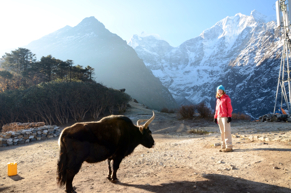
Lauren vs Yak, Tengboché

We had a relatively relaxed morning in Tengboché this morning. We went outside to take a few photos of the gorgeous mountains surrounding the village and were amazed by just how close they now appeared. The monastery looked stunning with the Tengkangboché mountains as backdrop.

We returned to the guesthouse for breakfast and let muesli with hot milk warm our bellies and prepare us for the hike that lay ahead.

Beyond Tengboché the trail followed the Imja Khola upstream. We descended from the Tengboché meadow to the river bank through yet more forest of birch and rhododendrons. After about an hour we reached Deboché. Continuing to follow the Imja Khola the trail now sat high above the river. We saw the remnants of numous landslides then quickly retreated away from the edge when we heard stones still falling from near where we stood.

Chris after crossing the steel box bridge

The valley narrowed into a gorge and before long we were crossing a steel box bridge to the West side of the river. Beyond the bridge we climbed a set of stone steps and looked back towards Tengboché, spotting the monastery, and realising just how far we had come. As we continued Ama Dablam was clearly visible out in front. We passed a few chortens before walking up stone steps and through the gateway which marked the entrance to Pangboché.

A chorten on the trek
Ama Dablam above yak pastures
Lauren leaving Pangboché with Everest and Ama Dablam

We passed through Pangboché, full of trekkers' lodges, and could see Everest poking out from behind the Lhotse-Nuptse ridge once again. We passed over a bridge and climbed our way up the steep slope to Shomaré.

Chris striding out towards Shomaré
Anando and Chris soak up some sun at Everest View Lodge, Shomaré

We asked about rooms and food at one lodge but were turned off by their menu advertising only single servings of dal bhat and Chris informing us that their toilet was a hole in the ground (like many we have used) only this one lacked any kind of composting system.

We settled on Everest View Lodge and tried out the Aussie from Tengboché's suggestion of bargaining. The room price of 100 rupees per person dropped to being free when we told them we would eat all of our meals at their restaurant. Considering that the lodges expected you to eat there anyway I'm not sure why this trick worked but it did and we're not complaining.

We had a lunch of dal bhat and tried to make the most of the multiple servings. Then it was rest time. Despite being advised not to nap at high altitude we gave in and snuck a half hour of sleep. When 2:30pm arrived it was time for acclimation and none of us were happy about it. We rugged up and headed out the door in search of a hill to climb.


Shomaré to the Hill North-West of Shomaré: The Stats

Distance Walked: 2.4km

Hours and Minutes Taken: 2 hours, 10 minutes

Origin Altitude: Shomaré, 4064m

Destination Altitude: Hill North-West of Shomaré, 4344m

Approximate Total Metres Ascended: 280m

Approximate Total Metres Descended: 280m

Weather: Cloudy getting colder, windier and foggier as we ascended. Clearing to blue skies as we descended

To begin with we followed the path that would tomorrow take us towards Dingboché. From there we spotted a hill rising to our left that was shrouded in cloud. It was perfect for acclimatisation in that it went up and up and up. For over an hour we forged a path through rocks and alpine scrub. It was a steep climb and, at over 4000m, it was tough work. We sheltered from the wind behind large boulders when we could but for the most part it was cold, windy work. Before long the wind picked up and we were well and truly within the cloud. We pulled our beanies down and our neck warmers up before continuing up and up some more.

Acclimatisation in the clouds

When Anando caught up we took a few minutes to breath in the little oxygen available before descending as fast as we could. It was darn cold up there and being in the cloud was making our clothes damp. As we climbed down we followed a gorge which looked more like the moon than anything that belonged on this Earth. The barren terrain had begun.

Back at our lodge we ordered some fried noodles and fried potatoes and sat in the restaurant, heated by burning yak dung. The lights flicked on and off as we ate giving our meal a disco vibe. The lodge only had enough solar power for one light at a time.

With Chris feeling less than average we had an early night. His headache was getting slightly worrying. As we lay in bed we realised that today had been two years since we met. What a way to celebrate.

The skies clear above Shomaré


Monday, 8 April 2013

Trekking Day 5: Namche Bazaar to Tengboché

A view of Kusum Kanguru range, looking back towards Namche

Namche Bazaar to Tengboche: The Stats

Distance Walked: 11.4km

Hours and Minutes Taken: 6 hours, 55 minutes

Origin Height: Namche Bazaar, 3450m

Destination Height: Tengboche, 3890m

Approximate Total Metres Ascended: 846m

Approximate Total Metres Descended: 459m

Weather: A clear, cool morning with clouds rolling in from around midday

Morning Temperature in our Tea House Room: 9 degrees Celsius

Chris enjoying a breakfast muffin above Namche Bazaar with the Kwange Range for views

Up before the sun this morning we left our guesthouse at 6am. The walk to the top of Namche Bazaar was more difficult than ever with our bags on our backs...the boys carrying almost 20kg each while I carried a little over 10. And, despite our room being the warmest we have experienced, this morning's walk was freezing. The cold air burnt our throats as we climbed the stairs to where we would have breakfast.

Thanks to our purchase of a few bakery snacks yesterday we enjoyed muffins and doughnuts this morning with views of Kwangde Range. From there we followed a path carved into the hillside which took us on mellow ups and downs more times than we could count. And with every 'down' all we could think about was the 'up' that would invariably follow.

Yaks marching the narrow path towards Namche

We stopped again a little further on and had some bread, jam and yak cheese while taking in more stunning views of Ama Dablam and Everest. Anando tried his hardest to hand sanatise everything in sight, namely the knife we were using to spread our jam, before we chatted to a solo French gentleman trekker and continued on our way.

Chris and Anando stride out through the forest towards Phunki Tenga

Winding our way around the hillside we eventually headed into a forested area. At a signposted junction our path joined with the path coming from Khumjung and another path leading towards Gokyo. From there we climbed rapidly down a stepped path, descending through a forest of blossoming rhododendrons and birch trees. Ama Dablam was visible up ahead while Thamserku remained visible on our right. It was a beautiful stretch of path all the way to Sanasa.

The broad trail once again was back following the Dudh Kosi river which flowed in the gorge to our right. The path continued to lead us down through yet more rhododendrons passing through the villages of Tashinga and Lausasa where Tibetans sold souvenirs that there was no way we were carrying with us for twenty days.

A dog takes in the views
The Dudh Kosi seen from Phunki Tenga

We descended still further down a zigzagging path slippery with sand and small rocks that quickly took us down 570m until level with the Dudh Kosi at the small settlement of Phunki Tenga which, at 3250m was the lowest point on today's trail. Here we stopped for a mid morning snack of fried rice and fried potatoes before contemplating the climb that was ahead of us.

The bridge just out of Phunki Tenga and the roaring Dudh Kosi below

A prayer flag decorated bridge took us across the river to where water-driver prayer wheels spun and to where we would again have our permits checked. Immediately after, the relentless climb to Tengboche began. Thankfully the walk was very scenic with thick bushes of rhododendrons blanketing the hillside.

Chris and Lauren with Mt Kantega

It was tough going as the path maintained its steep incline for what felt like forever. We took it slowly, watching as porters and tourists not laden with heavy bags powered past us. Soon Mt Kangtega, the 'snow saddle' came into view and the gradient mellowed somewhat.

Looking back down the valley at Kwangde Range

Before we knew it we had arrived at the gateway to Tengboche and, even with the clouds having already rolled in, Tengboche was as beautiful as described.

While we waited for Anando to make an appearance Chris went in search of accommodation. Tengboche's lodges are known to fill up quick forcing some tourists to walk to the next town. We were definitely not in the mood for any more walking so we took the first rooms offered at 200 rupees a pop.

After dumping our stuff in our room and throwing on some fresh clothes we ordered three servings of dal bhat and enjoyed every mouthful after our huge day. Once our bellies were full we retreated to our rooms for an hour's rest before our acclimatisation would force us to head out into the cold and walk higher in order to follow the trekker's motto of "trek high, sleep low."

Tengboche to the Hill East of Tengboché (and back): The Stats

Distance Walked: 2.7km

Hours and Minutes Taken: 1 hour, 53 minutes

Origin Height: Tengboché, 3890m

Destination Height: Hill East of Tengboche, 4101m

Approximate Total Metres Ascended: 232m

Approximate Total Metres Descended: 232m

Weather: Cloudy/foggy and cold. Light wind

Historical Buddah, Tengboché Monastery

Before setting off to acclimatise we visited the Tengboché Monastery, Khumbu's largest gompa. We removed our shoes, braving the chilly temperatures, so we could enter the gompa's temple hall. The hall was brightly decorated with murals and lined with cushions for the lamas to meditate. Atop each cushion was a thick, warm robe that we could only imagine was to keep them toasty while they meditate in these freezing temperatures. And this was Summer! Also inside the hall was a 4m tall statue of Buddah along with some huge drums/gongs. If only we could have been there to witness a ceremony.

Benches inside Tengboché Monastery
The wrong way to acclimatisation hill

After checking out the monastery we spotted a hill to the South-East of Tengboché with prayer flags leading to the top. Of course we decided that it would make a perfect acclimatisation destination. We found a trail leading through the forest but soon realised it did not lead to where we hoped.

Chris climbing amongst the prayer flags

We backtracked and spotted the large prayer flags with a tiny goat track which seemed to follow them up. We took it, ducking under bushes and manoeuvring around rocks until finally, breathless, we reached a structure at the top. While we caught our breath an Aussie and a Canadian guy appeared from the clouds. We spent some time chatting to them and they gave some good advice about bargaining at lodges. We didn't even know this was possible! They also told us that they had just climbed up to the top of the hill that we thought we had already reached the top of. Despite the thick cloud rolling in we decided to attempt the climb.

Anando and Lauren get religious by the prayer flags

It was a tough ask with the path looking more like a rocky goat track than anything else. We made it up far enough for snow to begin covering the ground. It was cold, cloudy and Chris still wasn't feeling well so we decided to descend. We climbed down to find Anando with his head torch on, flashing the emergency red lights. We had disappeared out of sight in the clouds momentarily and prompted this reaction.

The climb down to Tengboché was on a well maintained path very unlike the one we had climbed to the top. We emerged close to our tea house, dumped our stuff and went down to eat our pre-ordered dinner. The scene that awaited us was just as we imagined tea houses to be. The restaurant was packed with people in down jackets and beanies eating steaming plates and bowls of food with huge thermoses of tea. It was like a ski lodge.

We found seats and ate our preordered dinner of Sherpa stew and vegetable momos before consuming more than our fair share of ginger and honey tea. Chris' throat was playing up and we were attempting to remedy the situation.

We went into our room for an early night but were kept up by American trekkers stamping their way up and down the hallway. Add to that the fact that we needed to use the bathroom every half hour or so thanks to all the tea we had consumed and it wasn't the most restful sleep we had had.

Chris rugged up in the fog...acclimatising